|
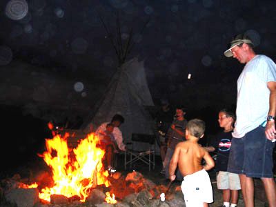
Last Chance is located near Yellowstone National Park. We met up with our friends, Don and Linda. We also met their daughter, Carrie, and her husband, John and kids, Ryan, Jake and Nicole from San Diego. They had rented a motorhome and drove up for their summer vacation. Mitch and Max enjoyed playing with the kids and Mitch enjoyed sharing the campground's teepee at night, (barely seen in this night shot.) |
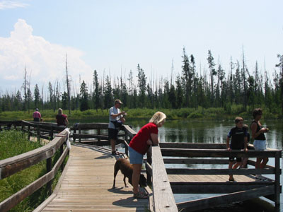 |
Here's one of the fishing holes in the area. Henry's Fork is a famous spot for fly fishing. We also floated rafts down the river and saw what looked like the same mama moose and calf, (now a teenager,) as we'd seen last year. This year we also passed by a few beavers. |
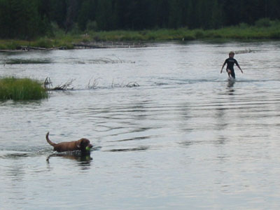
| I'm not sure who likes the river more, Cocoa or the kids.
The river we floated down flows from an underground spring and the river
and fish are protected. The water is crystal clear and the fish are
large and healthy.
It was odd to see a flowing river that had no upstream. It was surrounded by land on three sides. It looked like a small pond with a river flowing out of it. |
 |
 |
|
 |
 |
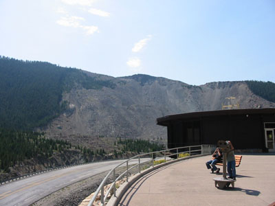 |
As we headed northwest, we came across a site that looked
very strange. There were the trunks of hundreds of dead trees sticking
out of the middle of a fairly wide lake. Then we saw the side of
a mountain that appeared to be completely cleared of all it's trees and
vegetation. We couldn't figure this out, so when we saw a visitor
information center we had to stop and check this out.
On August 17, 1959, at 11:37 p.m. an earthquake caused the mountain to shake. A massive part of the mountain broke, slid off and filled the valley below. Several people who were camping in the area were buried. 100 mile per hour winds were created from the falling earth. Massive boulders (broken bits of mountain) were stacked high on the other side of the valley. Over 40 years later, this is what's left. This site is called Earthquake Lake. It's located on Montana Highway 287, about 30 miles north of the town of West Yellowstone. |
 |
With the valley filled in, the river turned into a lake. A channel was quickly cleared to release some of the water. Had it not been cleared, the dam farther upstream would have been completely covered by water. I wonder what size tsunami would result if a slide of this size occurred under the ocean. |
 |
Our daughter-in-law, Melissa was easily able to identify
our last quiz question by using the Internet, so here's a harder question
for her. Where is this picture taken? (Don't worry Mel, I'm
just kidding.)
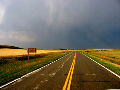
Actually, I took this picture to capture the look of being out in the middle of open country with the sharp gray color of an afternoon thunderstorm. |
 |
But here is our next challenge and there may be no web
clues here.
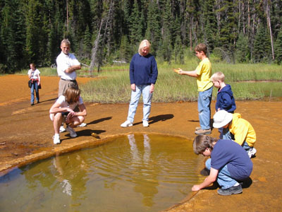
What stretch of highway has these two attractions within 10 miles of each other? 1. An area where spring water is rich in ironoxide and forms rust colored mounds. Native Americans used this area to collect material for body paints, and . . . . |
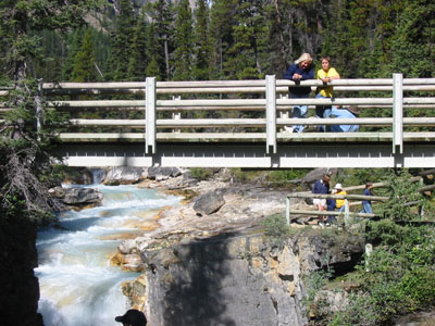 |
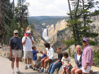
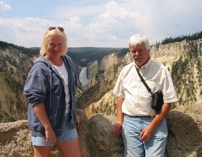
2. A small river has cut a deep, 200 foot, gorge through
the rocks. A wooden walkway cuts back and forth across the gorge.
This is the top of the gorge. Cheryl and Mitch are on one crossing
and Max, his uncle and cousins are by the waterfalls overlook. I
took the picture from yet another bridge.
Be the first to e-mail us the highway, nearest town or other landmark and win this month's contest. Obviously, everyone in these two pictures are disqualified. |
|
|
|
|
Next Adventure (Great Falls) |